The NZNTT is actively seeking updated information for all trees in the register. If you have information about this tree that we don't currently have recorded, or wish to advise of an inaccuracy please use our information submission form to help us build a complete profile of this tree.
Tree Information x
| Identifier: | CR/G2152 |
|---|---|
| Tree Type: | Group |
| Registered By: | Hammer, J.R. |
| Registration Category: | Notable tree – National interest |
| General Notes:
|
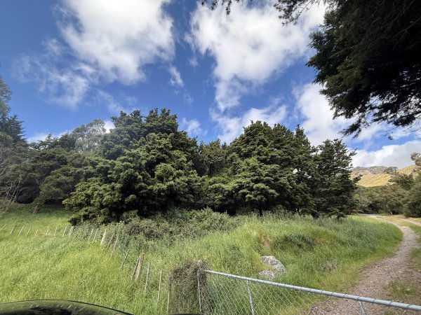
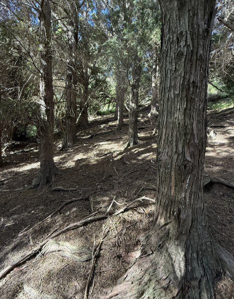
This small stand of totara was planted as a national trial in 1910 on a slope in pasture at this location. At planting, partial shelter was provided by natural kanuka, fivefinger (Pseudopanax arboreus (Murr.) Philipson), and Olearia species. The soils are Pawson Hill soils, mostly silt loams developed from greywacke with some basalt and rated as medium natural fertility. Initial spacing was 2 × 2 m.
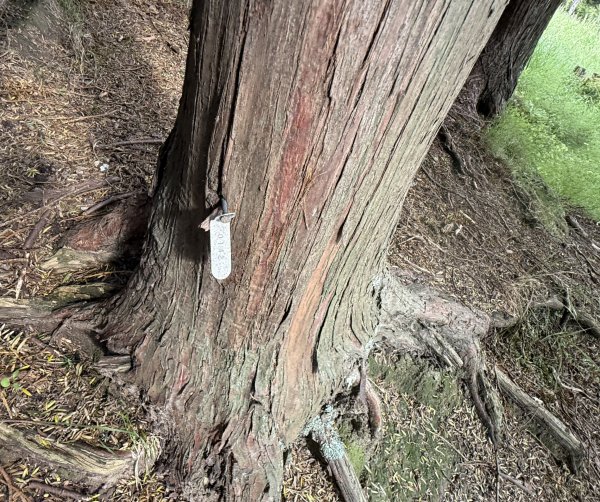
When inspected in 1986 and in 1998, cattle trampling and damage to root systems were evident. Gaps in the stand indicated some earlier mortality had occurred. Growth has been slow compared with similar-aged totara on other sites. Stem form of interior trees is considered good for an untended stand, with clear boles up to 7 m. The largest Totara in 2025 was 303cm DBH, Height of 12.7m and a canopy spread of 11.6 x 8.2 m. (Hammer, J.R., 2025). Reference GROWTH AND YIELD OF TOTARA IN PLANTED STANDS D.O. BERGIN and M.O. KIMBERLEY New Zealand Forest Research Institute, Private Bag 3020, Rotorua, New Zealand (Received for publication 28 March 2000; revision 26 September 2003) |
Group Details
| Group Type: | Single species | |
|---|---|---|
| Feature Tree Genus: | Podocarpus | |
| Feature Tree Species: | totara | |
| Feature Tree Common Names: | tōtara, | |
| QE II Covenanted: | No | |
| Actual Planting Date: | 1910 | |
| Approx. Planting Date: |
e.g. circa. 1860 |
|
| Current Age: | 116 years | |
| Tree Health Description: | Mostly healthy | |
| Local Protection Status: | No | |
| Tree Present: | Yes | |
| Number of Trees: | 56 | |
| Area Covered: | 100m squared | |
| Group of Tree Type: | Woodland |
Observations
| Date | Observer | Action |
|---|---|---|
| 17 Nov 2025 | Hammer, J.R. |
Location
|
|||||||||||||||||||||
Images
| Preview | Credit | Date |
|---|---|---|
 |
Ra Hammer | 18 Nov 2025 |
 |
Ra Hammer | 18 Nov 2025 |
 |
Ra Hammer | 18 Nov 2025 |